Thousands of riders, me included, will take on the Etape du Tour in July. The mountainous 130km route follows stage 20 of the Tour de France, taking in a series of lesser known climbs around Annecy, including a steep summit finish, and thereby avoiding the headline climbs that feature earlier in the 100th edition of the race.
So how hard is the route? That’s the question on the lips of every rider training to tackle this year’s Etape. Chris Barrow, a cyclist, ski instructor and owner of the Chalet La Charme in the French Alps set off to find out.
This year’s Etape du Tour takes place in little over two months time, on Sunday July 7, and follows a broad loop on a tour of the less well known Massif des Bauges, south of Annecy.
And because the route doesn’t tackle any “famous” climbs and cols, cycling purists have denigrated the event to a “why bother” route, or a Sunday afternoon leg stretcher after doing Saturday’s altogether tougher La Marmotte. The Etape is only 130km, how hard can it be? I set off to find out.
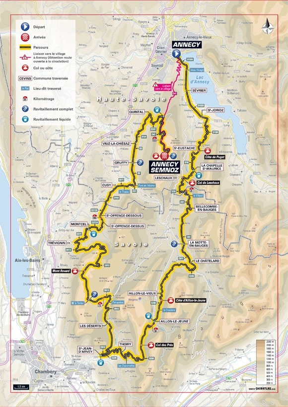
Departing Annecy town centre at 10am, I followed the excellent cycle path along the shores of the stunning Lake Annecy, until arriving at the small lakeside town of St-Jorioz. The actual event will take place on the main road, a flat 7.5km run, before turning south at St-Jorioz and hitting the first climb.
The Côte de Puget is 5.4km at an average gradient of 5.8 per cent. It’s not too long, and never too steep, and can be tackled in relative comfort by reasonably fit cyclists. UK cyclists with no alpine training would be advised to take this first climb gently – there’s a long way to go!
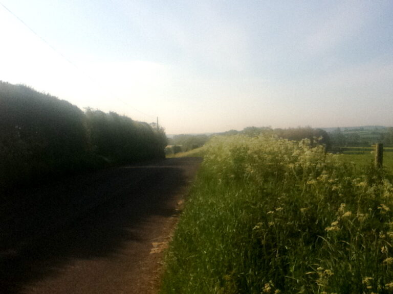
A short descent to le Cruet is followed by the second climb. On the official Etape website, this is listed as the climb to the Col de Leschaux, 3.6km at 6.2 per cent. This is slightly misleading. The climb begins at le Cruet, climbs through the hamlet of St-Eustache and ends in La Chapelle-St-Maurice. Again, it’s not a tough climb by any stretch, it reminded me of Normandy, with its rolling hills through the green countryside. Unlike Normandy, rock walls tower above to the left, and on the right is the Semnoz, to be climbed much later from the other side. After La Chapelle-St-Maurice, the route descends quickly to the Col de Leschaux.
Fast and flat is how I would describe the few kilometres from the Col de Leschaux to Bellecombe-en-Bauges. Following Bellecombe, a short, punchy climb finds us in La Motte-en-Bauges, and a few kilometres later comes a very short climb through the centre of Le Châtelard.
Descending out of Le Châtelard, the route takes a right turn over the river, and hits the six kilometre climb to Aillons-le-Vieux. At an average of four per cent, it’s steady but not that hard. It’s important to keep taking fluids and fuel at this stage, and to keep energy for the second half of the route. A short descent into Aillons-le-Jeune, and the first of the three hardest climbs arrives. The Col du Prés, 3.5km at 6.5 per cent is, on paper, quite straightforward. However, the heat of a July day, coupled with a headwind, will quite possibly make the climb feel a whole lot harder. The descent from the Col du Prés is fast and technical, passing through Thoiry, with views of Chambery down below. Another short, punchy climb is encountered after crossing the River Leysse on the way up to St-Jean-d’Arvey.
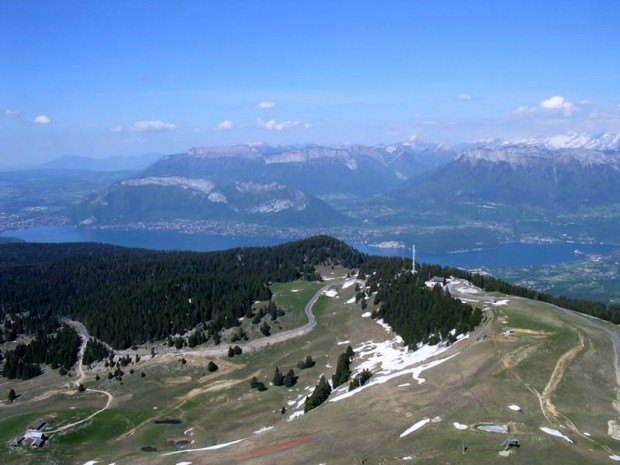
This marks the halfway point of the route, with ‘only’ the two main climbs to come. The first of which, the 16km climb to Mont Revard is long, but not steep by alpine standards. At a gradient of 5.4 per cent, it’s important to get the right cadence and rhythm, and not to expend too much energy. In many places, the gradient eases off to almost nothing, so there’s plenty of opportunity to rest, eat and drink.
A long descent follows, then a sharp turn right before Trévignin, and along flowing country lanes through the hamlets of Montcel, St-Offenge and Cusy. After a very short climb out of Cusy, the route forks left and drops down into the gorge, crossing the Pont de l’Abime.
This is a stunning bridge over the Chéran gorge, and is immediately followed by (another) short, punchy ramp into Gruffy. Onwards to Viuz-la-Chiésaz, where there is another short climb up to Quintal. By this stage, you will have covered almost 120km – and the climb to the Semnoz is the last obstacle.
An 11km climb at an average gradient of 8.3 per cent, and after 120km of cycling, this is (in my opinion) a tough climb. Straight out of Quintal, it’s steep and unrelenting, through green forests and white limestone. I can see why it reminds the organisers of Mont Ventoux. After about three kilometres, it eases ever so slightly, just before the junction with the D41 coming up from Annecy. Take a right here and just keep spinning. It’s another seven kilometres or so at a fairly consistently steep gradient. If the sun’s shining, which it was during my ride, it’s hard work. In July, it may be unbearable.
But if you make it to Semnoz, be proud of your achievement, and dismiss the killjoys who relegate this event to just another club ride. For sure, this Etape doesn’t have the high altitude alpine cols or summits. Nor does it have the massive distances of some if its previous incarnates. But with about of 3,500m of climbing, it’s definitely not a walk in the park, and my feeling is that some of the more dismissive riders might be in for a shock.
Chalet La Charme is a five-bedroom chalet in St Gervais Le Bains, one hour from Annecy, offering summer and winter accommodation in the French Alps. Visit www.chaletlacharme.wordpress.com for more information.
RoadCyclingUK’s George Scott is riding the Etape du Tour with Sports Tours International, who offer a comprehensive range of cycling tours and holidays, as well as packages to European sportives including the Etape du Tour, La Marmotte and the Paris-Roubaix Challenge.

